
Whitewater Rafting:

We know your type.  You like your water with a little kick.  No rowing your boat gently down the stream for you.  Well, Genuine Montana has you covered.  Great Falls is centered in a region that offers whitewater from spring right through fall in about every direction.  Regional rivers boast big waves, incredibly clear water and unbelievable scenery.  All routes mentioned here include technical water and require specialized water craft and intermediate level river navigational skills.  Water temperatures rarely exceed 50 degrees even in late summer and can be in the 30’s in early spring.

Dearborn River

(Highway 287 Bridge to Mid-Canyon on Missouri River) 16 Miles
Class:  II-III
Season and Flow:  Early spring to early summer.  Flow range of 400 to 2000 cfs
Flow Gauge:  https://waterdata.usgs.gov/usa/nwis/uv?06073500

Description:  This section of the Dearborn is very scenic as it snakes through high canyon walls.  For being only 40 miles from Great Falls, the river traverses an impressively remote roadless area with almost no river access except at the put in and take out.  Three noticeable rapids are located on the Dearborn, with the most notable being a boulder garden near the middle of the float with a good size hole.  This unnamed rapid is considered a Class III.  Most of the day will be spent trying to avoid hitting the canyon walls as the Dearborn snakes through its course.

Drive Time from Great Falls:  45 minutes

Directions:  From Great Falls take I-15 north for 2.4 miles to Vaughn/Highway 200 exit.  Take Montana 200 west for 52 miles to Highway 287 and turn left.  Go approximately 8 miles to the bridge crossing of the Dearborn.  Start at the well-designed put in where the Dearborn crosses Highway 287.  The Dearborn will flow into the Missouri river within sight of I-15 near Craig, Montana.  The take out is just a mile downstream at the Mid-Canyon river access which has campsites.

Blackfoot River

The Blackfoot offers numerous possibilities of public put in and take-outs in its floatable sections.  Areas above Russel Gates are generally flat with occasional class II water.  Below Russell Gates, the elevation drops quicker.  There are more boulder gardens and the water is more consistently Class II with several Class III sections; most notedly the rapid at the Roundup Bridge (Highway 200) and Thibodeau.   Many outfitters offer commercial trips on the Blackfoot.  Here is a river mileage chart for the primary river access points on the river:

  • Cedar Meadows FAS: 64.4
  • River Junction FAS: 52.5
  • Russell Gates FAS: 40.1
  • Sunset Hill FAS: 31.4
  • Roundup FAS: 29
  • Ninemile Prairie FAS: 25.1
  • Corricks River Bend FAS: 23
  • Belmont Creek FAS: 21.2
  • Red Rocks FAS: 19
  • Thibodeau FAS: 17.7
  • Sheep Flats FAS: 16.7
  • Johnsrud Park FAS: 12.6

Blackfoot

(Russel Gates Campground to Ninemile Prairie Campground)   15 miles
Class:  II-III
Season and Flow:  Early spring to summer.   Flow range:  500 to 10,000 cfs
Flow Gauge:  https://waterdata.usgs.gov/usa/nwis/uv?12340000

Description:  This section of the Blackfoot is a nice float of fairly tame Class II water close to Highway 200 for much of the trip.   The Class III rapid at the Roundup bridge where the river crosses Highway 200 is fairly technical in most water levels.  At levels above 3,000, the rapid develops fairly large sloshing waves from both sides.  In lower water levels, this rapid is boulder strewn.  It can easily be scouted from Highway 200 during the car shuttle.

Drive Time from Great Falls:  2 hours

Directions: From Great Falls take I-15 north for 2.4 miles to Vaughn/Highway 200 exit.  Take Montana 200 west for 124 miles to Russell Gates Fishing Access on the left.  A small first-come-first-serve campground is located here.  The Ninemile Prairie Campground is reached by travelling 19 miles to Ninemile Prairie Road on the right.  The Campground is approximately 4.5 miles down the gravel road.

Blackfoot

(Roundup Bridge to Johnsrud Fishing Access) 16 miles
Class:  II-III
Season and Flow:  Early spring to summer.   Flow range:  500 to 10,000 cfs
Flow Gauge:  https://waterdata.usgs.gov/usa/nwis/uv?12340000

Description:  At flow rates above 4,000, this reach of river has fairly consistent mellow rapids along most the float.  Several are technical enough to be Class II, requiring some route finding.  However, the major rapid in this segment, Thibodeau Falls, is easier than at lower levels when it is considered a Class III.  The river meanders away from Highway 200 for most of this float making for a very scenic and enjoyable river trip.

Drive Time from Great Falls:  2.5 hours

Directions:  From Great Falls take I-15 north for 2.4 miles to Vaughn/Highway 200 exit.  Take Montana 200 west for 133 miles to the Roundup bridge where the Blackfoot river crosses Highway 200.  Turn right on Ninemile Prairie Road.  The put in is immediately to the left.  There is a boat slide made out of timbers and this site has limited parking.  To get to the takeout, travel an additional 15 miles west on Highway 200 to Johnsrud Park Road.  Turn right and follow the road 0.30 miles to the river access.

Middle Fork of the Flathead

(Bear Creek to Paola Creek 12 miles)
Class:  II-III
Season and Flow:  Early spring to late summer.   Flow range:  1,000 to 9,000 cfs
Flow Gauge:  https://waterdata.usgs.gov/usa/nwis/uv?12358500

Description:  If you haven’t floated this, you should.  Unique for its unbelievably clear blue-green water, fun swimming holes and abundant mountain goat sightings right on shore, this stretch of river is something special.  Nearly all rapids on this float are Class II, mild, scout-from-the-boat affairs.  However, at higher flows, the water can be pushy and both the Bear Creek (Class III) and Staircase rapids (Class III) have large rocks that are capable of pinning or flipping a raft, so attention must be paid.  Both rapids are several miles from the put-in.  A number of the West Glacier based rafting companies offer this stretch of river.

Drive Time from Great Falls:  2.5 hours

Directions:  From Great Falls, take I-15 North for 69 miles to the Valier Exit (Montana 44).  Follow M-44 west for 28 miles through Valier to T-intersection at US-89 and turn right.  US-89 will join US-2 just outside of Browning by turning left.  Follow US-2 37 miles west out of Browning to the Bear Creek Boat Launch and Campground.  To get to the takeout, travel 9.2 miles west on US-2 from the Bear Creek launch to the Paola River Access Boating Site.

Middle Fork of the Flathead

(Moccasin Creek to West Glacier 7 miles)
Class:  III+
Season and Flow:  Early spring to late summer.   Flow range:  1,000 to 8,000 cfs
Flow Gauge:  https://waterdata.usgs.gov/usa/nwis/uv?12358500

Description:  This reach of river is very popular with the West Glacier-based commercial river runners.  You will have plenty of company at the put-in, so plan to be efficient.  Once on the river, the first two miles are mostly flat water.  As the canyon narrows and becomes rockier, the fun stuff begins.  There are a number of named rapids, but the primary Class III, Bonecrusher, is the second major rapid.  The rapid can be scouted from the river and is run in a notch between rocks on the middle left of the river.  After Bonecrusher, there are many named rapids remaining but most are Class II affairs.  The river has a number of forks and rock gardens so pay close attention to the flow of water or you may end up stuck in a low flow channel.  Incredible blue-green water and several fun swimming holes make this a fantastic trip.

Drive Time from Great Falls:  2.75 hours

Directions:  From Great Falls, take I-15 North for 69 miles to the Valier Exit (Montana 44)  Follow M-44 west 28 miles through Valier to T-intersection at US-89 and turn right.  US-89 will join US-2 just outside of Browning by turning left.  Follow US-2 60 miles west out of Browning to the Moccasin Creek Boat Launch.  To get to the takeout, travel 7.4 miles west on US-2 from the Moccasin Creek.  Turn right on the Going-to-the-Sun Road and go 0.2 miles to a left at River Bend Dr.  Go 1.2 miles, turning right at the golf course to stay on River Bend Dr.  Look for the West Glacier River Access Boating Site on the right.

yankee jim

Yellowstone River Yankee Jim Canyon

(Corwin Springs Fishing Access to Carbella Fishing Access) 9 miles
Class:  III-IV
Season and Flow:  Early spring to fall.   Flow range:  1,000 cfs to 20,000 cfs
Flow Gauge:  https://waterdata.usgs.gov/usa/nwis/uv?06191500

Description:  At high flow in spring, this stretch can have very pushy water and big waves worthy of a Class IV.  By August, the river is often running at 4,000 cfs or less making this a solid Class III stretch.    The first two miles from this put in is flat and uneventful, but provides time for lunch and warm up before the last five miles which has consistent rapids.  Also, some great wildlife watching here with elk and eagles often visible.  The first rapid is a long bouncy trail of multiple rapids along the right side of river called Yankee Jim’s Revenge.  It can be missed completely on river left.  The next feature is a large boulder in the middle of the river named Big Rock Rapid.  Shortly after, comes Boxcar, a solid Class III-IV feature.  A large boulder on the left force’s traffic to the right and at some water levels a rock appears on the right.  As the water squeezes into the feature, a large curling wave awaits and several holes and waves follow before reaching a pool.  From here, the water-snakes through a canyon with several more small rapids remaining before reaching the takeout at Carbella.  Several commercial companies in Gardiner offer trips on this stretch of river.

Drive Time from Great Falls:  3.5 hours

Directions: Follow US-89 170 miles south from Great Falls to the intersection with I-15.  Take I-15 West for about 3 miles taking the second Livingston exit.  Turn left off exit and resume traveling south on US-89 for 47 miles to Corwin Springs, MT.  Turn right to cross the bridge and turn left on the dirt road.  Look for the fishing access sight to the immediate left.  To get to the take out, travel north on US-89 9.9 miles and turn left into Carbella River Access and Campground.

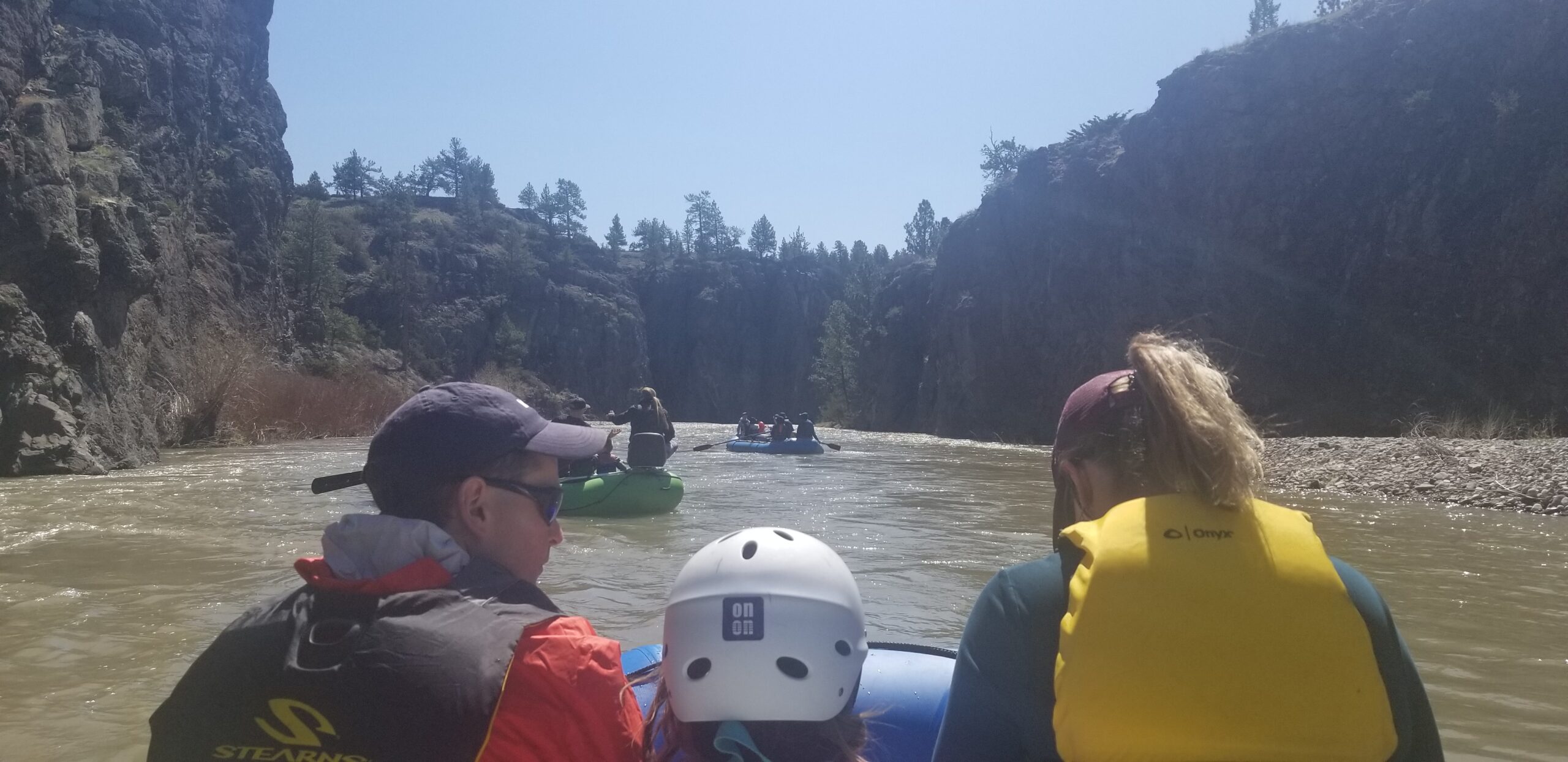
Clark Fork Alberton Gorge

(Cyr Bridge to Tarkio Fishing Access) 12 miles
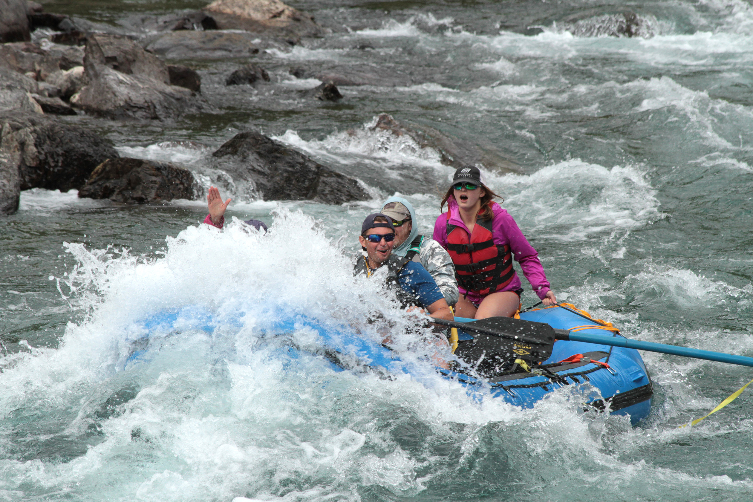
Class:  III-IV
Season and Flow:  Year around.   Flow range:  1,000 to 20,000 cfs
Flow Gauge:  https://waterdata.usgs.gov/usa/nwis/uv?12354500

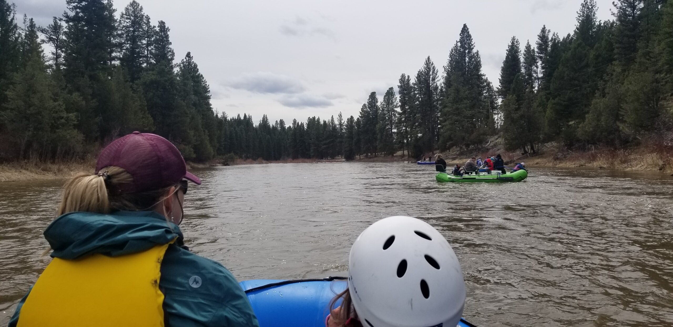
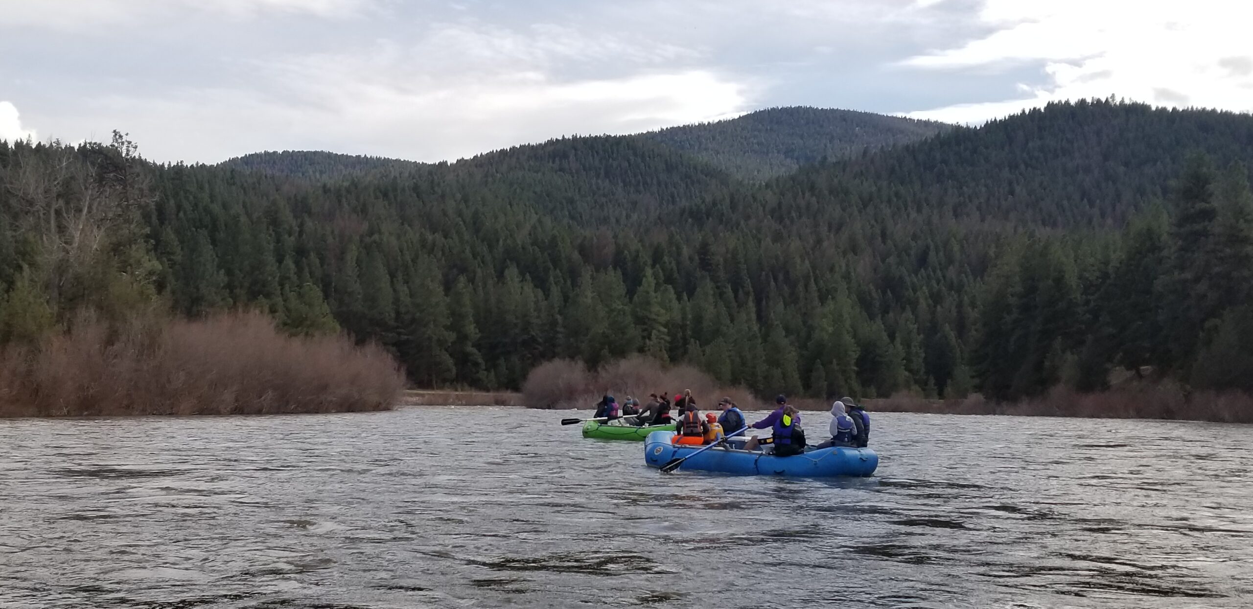
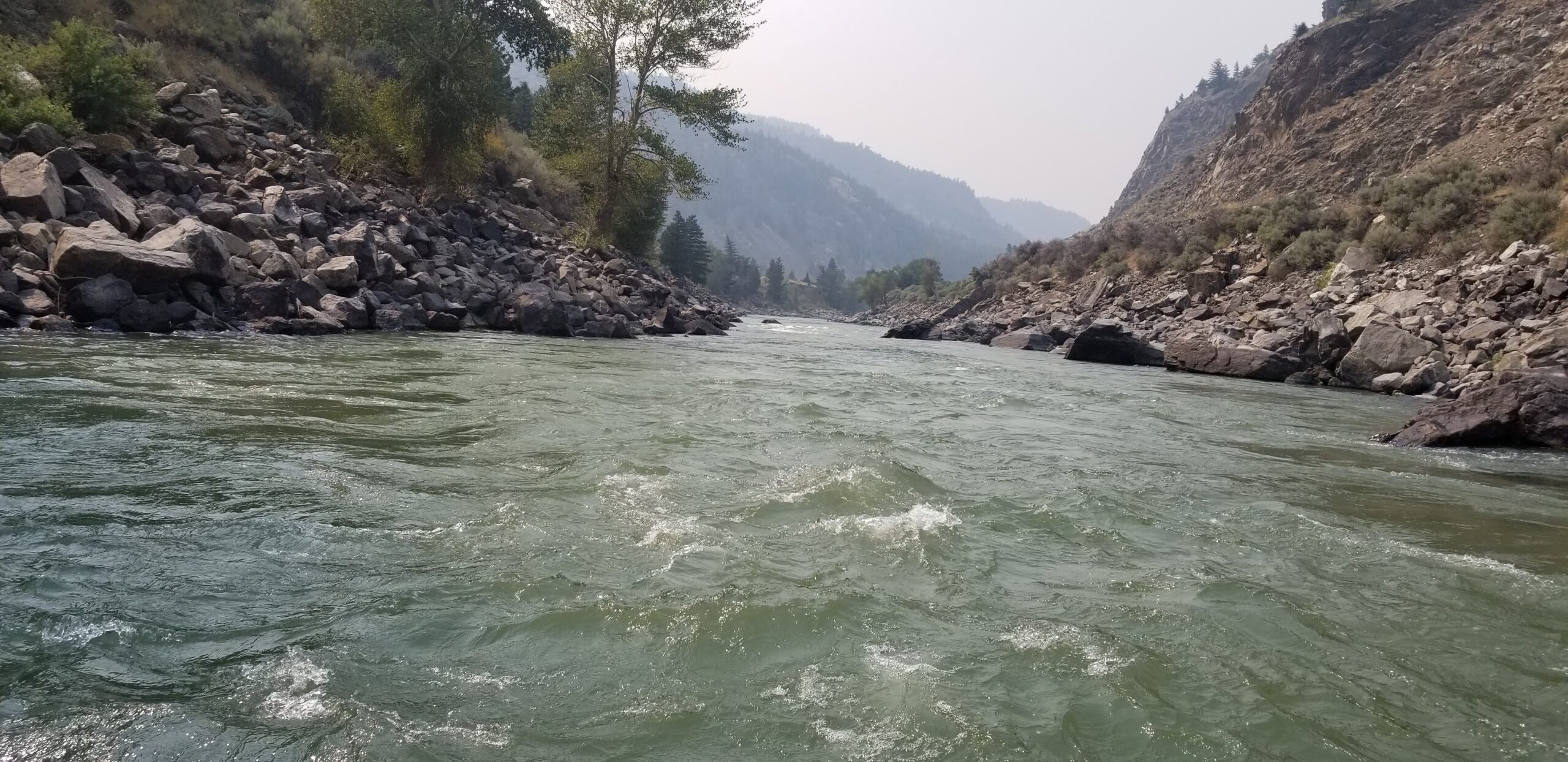
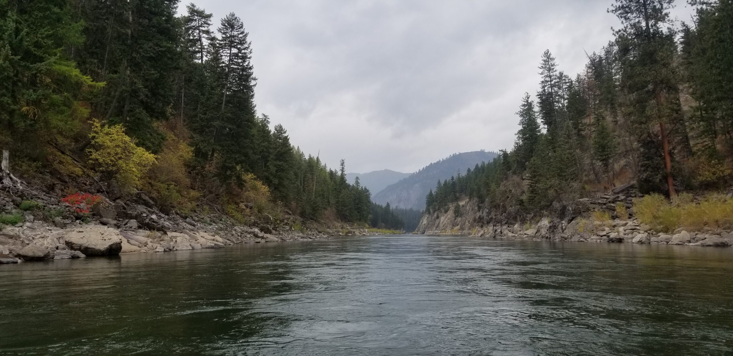
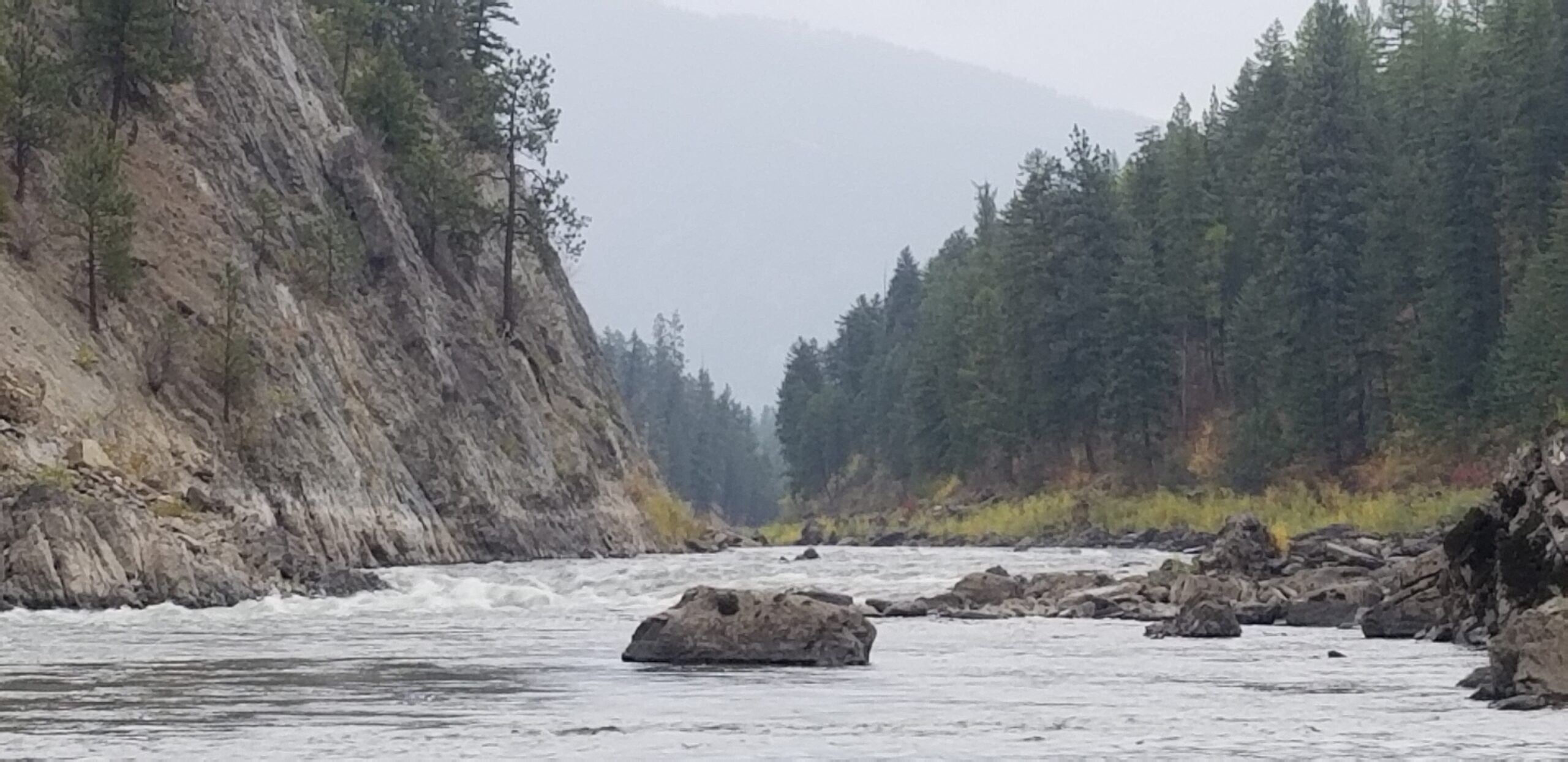
Description:  A very scenic river full of purple cliffs, river shelfs and large boulders; the Clark Fork holds enough water so that dragging bottom is never an issue.  At high flow, this river has very powerful water with several Class IV rapids.  At lower levels, these rapids have more rocks requiring more navigation to avoid a pin and still worthy of Class III+ ratings.  The first third of the river starts with several straight forward Class II rapids.  After a gap in the action to grab a drink, you will navigate several very scenic Class III rapids: the Ledge, Cliffside I and Cliffside II all run from river right moving left to avoid rocks.  The next third of the river is raucous and begins with a crossing under the Three Bridges (I-90, railroad, frontage).  You will be met with the big waves of Triple Bridge rapid (Class III) under the final bridge.  A short gap follows before Split Rock also a Class III, which is immediately followed by Tumbleweed a Class IV which is at a pinch in the river making for very quick water.  Run it from the river left.  Surfer Joe follows (Class II) then is immediately followed by Boat Flipper, a Class III at high flow and Boat Eater, a Class III.  Immediately get comfortable for the large converging waves of Fang, a Class IV.  Fang is run from right back to the left with a wary eye for large flip-worthy waves that come from both sides.  Thanksgiving rapid a Class II remains before a long and calm float past very pretty scenery and a well-deserved beverage for the boat skipper!

Drive Time from Great Falls:  3.25 hours

Directions: From Great Falls take I-15 north for 2.4 miles to Vaughn/Highway 200 exit.  Take Montana 200 west for 140 miles to Bonner, Montana.  Continue straight to I-90 west.  Travel I-90 West for 40 miles to Cyr Exit 70.  Continue straight after exit and cross the river on the frontage road bridge.  Turn left and look for put in on left.  This put in has a ridiculously long boat slide that is very well built.  To get to the take out, take Fish Creek Road west for 2.7 miles to I-90 west.  Travel five miles to Exit 61 toward Tarkio.  Go left off exit, across I-90.  Turn left onto River Gorge Road, follow that as it snakes down to a boat ramp.